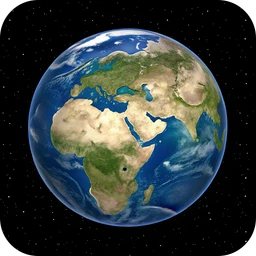
3D Earth Map - Satellite View3.3.6
Explore the 3D world. Navigate satellite map and 3D Earth views.
v3.3.6
This title isn't mirrored on MirrorNest — see how we source software for why. The button above goes straight to the official publisher.
Screenshots
About
View Earth as a three-dimensional globe, move across satellite maps, and examine locations from a mobile device with 3D Earth Map - Satellite View. The app can determine your location, help you inspect places around the world, and switch between a global globe view and closer views of particular regions. Its satellite map is described as providing real-time updates on changes and developments around the world.
You can zoom in on both the 3D Earth view and the standard satellite map to study landscapes, cities, landmarks, and different types of terrain. Country flags provide another way to identify nations while exploring their locations. Switching between satellite imagery and the globe gives the same place distinct visual perspectives, from broad geographic context to local detail.
The app is aimed at travelers planning to understand destinations, geography learners examining the planet, and curious users exploring maps and terrain. It suits quick location checks as well as leisurely geographic exploration, with the ability to move from worldwide views to specific areas.
3D Earth Map - Satellite View is freeware for Android and belongs to the Navigation & Travel category. The current version is 3.3.6. A paid version with additional features is also available, while the freeware edition provides the core globe and satellite-view experience.
Free to use — a paid version with additional features is also available.
What's new in v3.3.6
We're always working to make the app better for you.
Details
Version history
| Version | Size | Published | Scan | |
|---|---|---|---|---|
| v3.3.5 | — | 9/18/2026 | Not hosted here |
Does this still work for you?
Reviews
No reviews yet — be the first.
3D Earth Map - Satellite View alternatives

HK Transport
An app displaying transport mode in Hong Kong with a respect to your privacy.

TICE – Secure GPS Location Sharing with Friends
Meet up and locate your friends, family and colleagues on a map

2GIS: Offline map & navigation
Offline map, GPS navigation, live traffic, parking, transit routes, and more
BRouter
Get elevation-aware cycling directions
Yandex Maps and Navigator
Search organizations, get directions, traffic & transport info, use maps offline

Citymapper
Route Planner for City Navigation: MTA MBTA NJ Transit Bus Times & Subway Map